
GARDEN ROUTE | KAROO NEWS - A well-developed cold front is expected to make landfall over the southwestern parts of the Western Cape on Sunday afternoon into Monday.
As the cold front moves eastwards, significant wave heights of 4.0 to 5.0m are expected between Saldanha Bay and Plettenberg Bay from Monday to Wednesday.
These conditions together with strong winds may result in rough and choppy seas.
Very cold, wet and windy forecast
A series of cold fronts are expected to affect the Western and Northern Cape from Sunday throughout the week. This will cause day time temperatures to drop significantly from Monday.
Maximum temperatures may be below 10° C in places over the Namakwa district (N. Cape) and interior of Western Cape from Monday until Wednesday, but very cold weather likely remain throughout the week.
General windy conditions will accompany the cold and wet weather.
Due to the wind chill factor, temperatures may feel colder than the measured values.
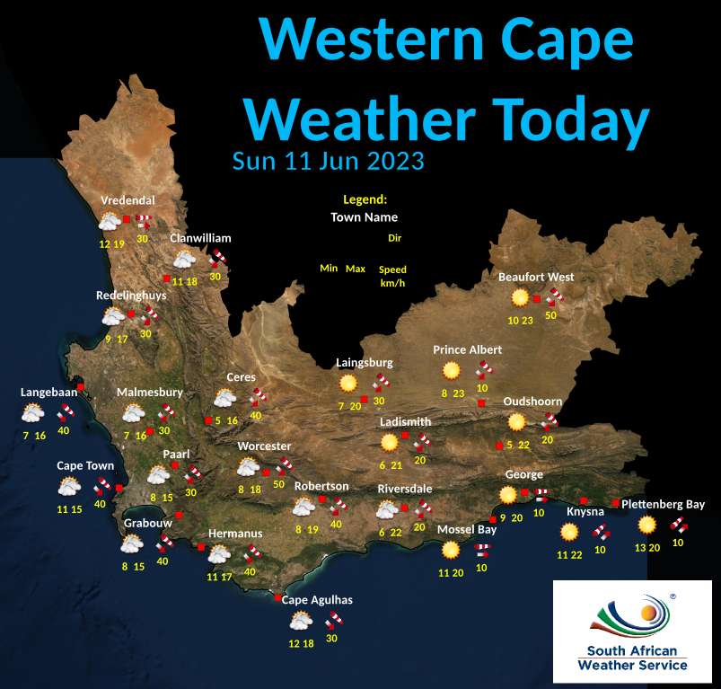
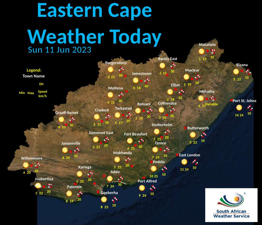
Day temperatures on Sunday 11 June:
‘We bring you the latest Garden Route, Hessequa, Karoo news’