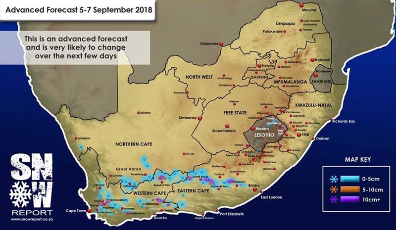
GRAAFF-REINET NEWS – Snow Report SA issued a weather report this morning predicting possible snowfalls for Thursday evening, 6 September, that might bring a blanket of snow to Graaff-Reinet’s surrounds.
‘The next cold front is due to make landfall in the Western Cape tomorrow afternoon (Tuesday). The first snowfalls are expected in the Western Cape on Tuesday night, through to Wednesday morning. On Thursday evening, the snowfall should stretch further east into the Graaff-Reinet area,’ the report said.
The report continued to state that, “by Friday morning, snow is expected around the Cradock, Hogsback and Nieu-Bethesda regions.”
At the moment, most snowfalls are expected to be light (less than 5cm), but a few isolated areas could experience heavier falls of between 5cm and 20cm.
Snow Report SA concluded the report by stating that they will keep an eye on this system, and will give an update again if there are significant changes to the forecast.
'We bring you the latest Graaff-Reinet, Karoo news'