


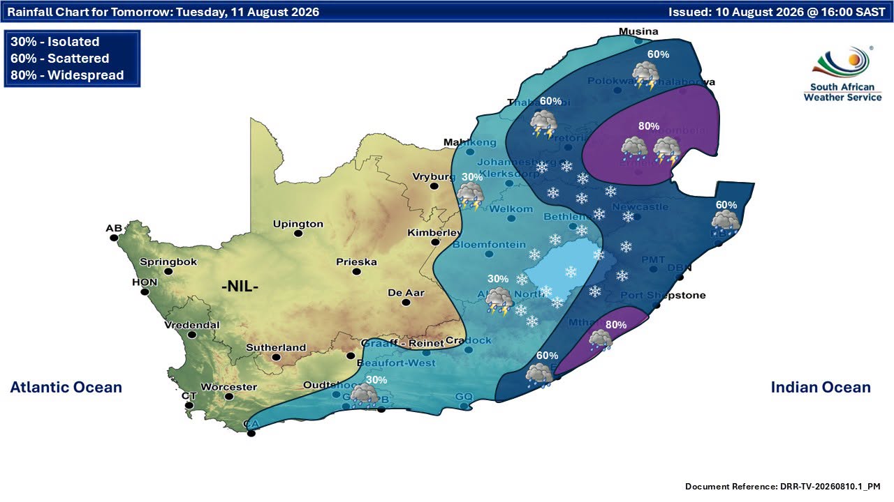
NATIONAL NEWS - The South African Weather Service (SAWS) said on Tuesday that the southern parts of the Free State, Northern Cape, Gauteng and Mpumalanga, as well as the interior of the Eastern Cape and KwaZulu-Natal, can expect wet, very cold and windy conditions.
Snow is possible over mountainous areas, while rough seas are expected along parts of the coast.
“Farmers and the public in general are advised to take necessary precautions,” SAWS said.
Severe snow warning for Eastern Cape
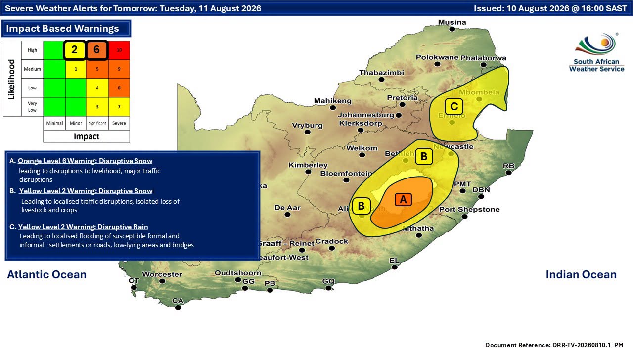
An Orange Level 6 warning for disruptive snow has been issued for Emalahleni, Sakhisizwe, Senqu, Elundini and Matatiele in the Eastern Cape.
The snow could disrupt livelihoods, cause major traffic disruptions and temporarily leave some communities inaccessible.
A Yellow Level 2 warning for disruptive snow is also in place for parts of the Eastern Cape, including Dr Beyers Naude, Raymond Mhlaba, Amahlathi, Intsika Yethu, Dr AB Xuma, Mhlontlo and Mzimvubu local municipalities, as well as Chris Hani District Municipality.
The warning also covers the eastern and southern parts of the Free State along the Lesotho border and western parts of KwaZulu-Natal.
Rain, wind and rough seas
A Yellow Level 2 warning for disruptive rain has been issued for Mpumalanga, except the extreme western parts of the province.
The rain could result in localised flooding of susceptible settlements, roads and bridges.
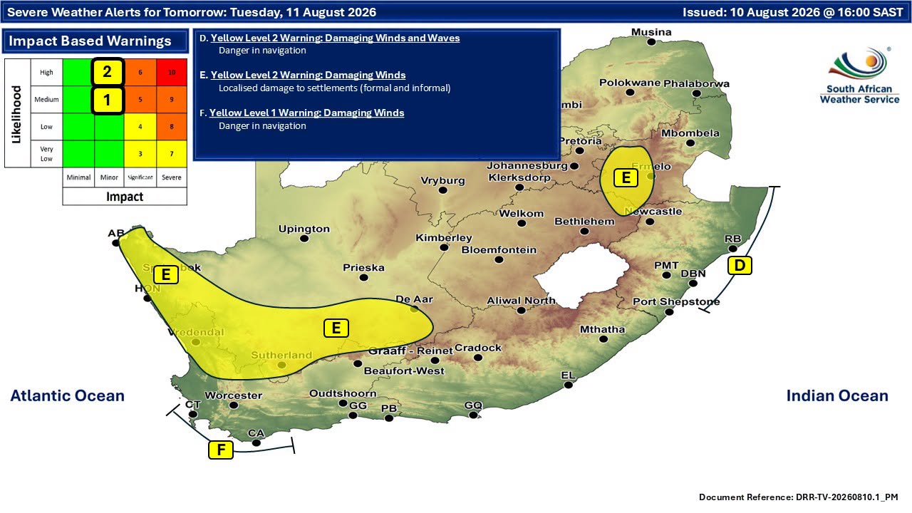
Along the KwaZulu-Natal coast, a Yellow Level 2 warning for damaging winds and waves has been issued. The conditions could affect small harbours and ports, navigation and coastal activities, while posing risks to infrastructure, settlements and people.
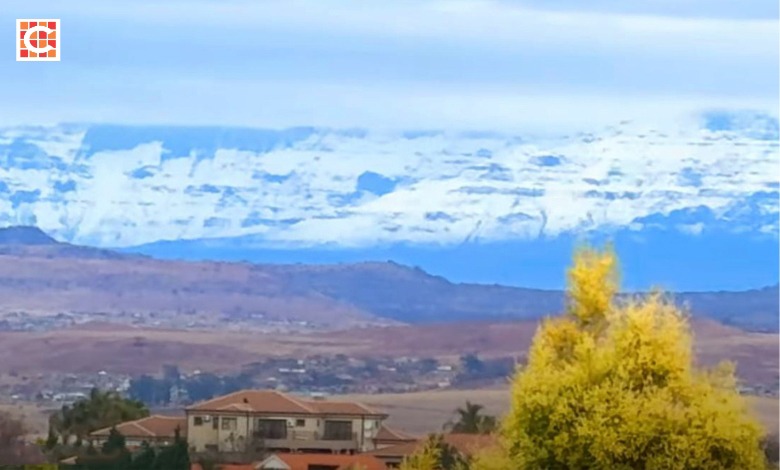 Snow blankets the Drakensberg mountains this morning, as seen from Ladysmith. Screenshot: Facebook/Ladysmith Gazette
In the Western Cape, a Yellow Level 2 warning for damaging winds has been issued for the northern parts of the West Coast District and Witzenberg Municipality.
A similar warning applies to the Namakwa District in the Northern Cape, except the north-eastern parts of Pofadder Municipality, as well as the western parts of Mpumalanga.
Strong winds between Cape Town and Agulhas
A Yellow Level 1 warning for damaging winds is in place between Table Bay and Cape Agulhas from Tuesday morning until Wednesday afternoon, 11–12 August.
The winds are expected to make navigation at sea difficult.
Extremely high fire danger conditions are also expected over the Richtersveld Municipality.
Residents, motorists, farmers and those working or travelling near the coast are urged to take the necessary precautions as the winter system moves across the country.
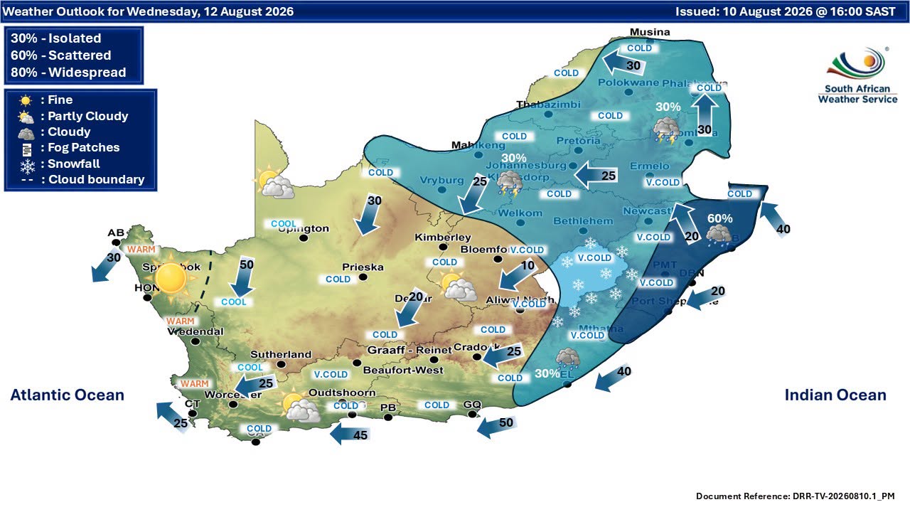
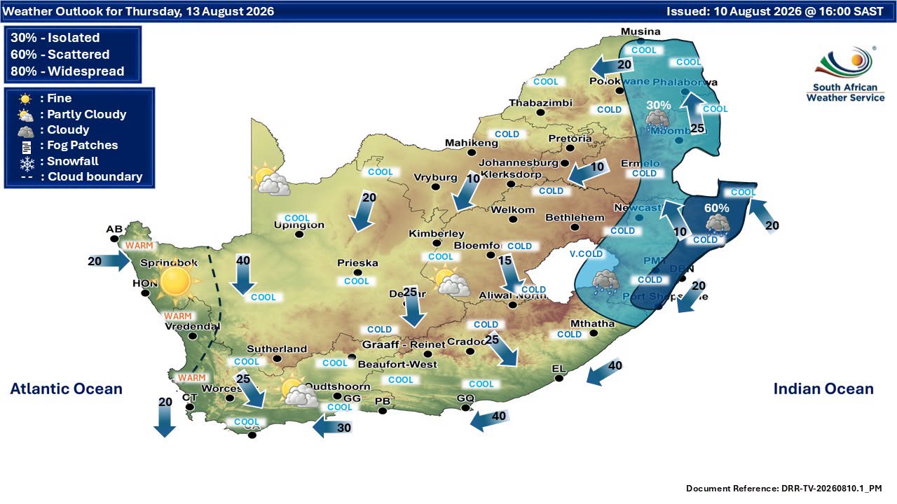
Weather forecast for Wednesday and Thursday:
‘We bring you the latest Garden Route, Hessequa, Karoo news’