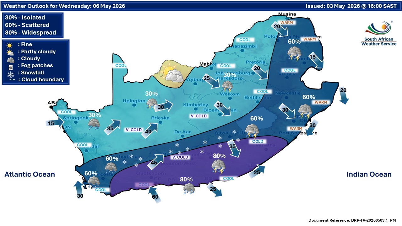
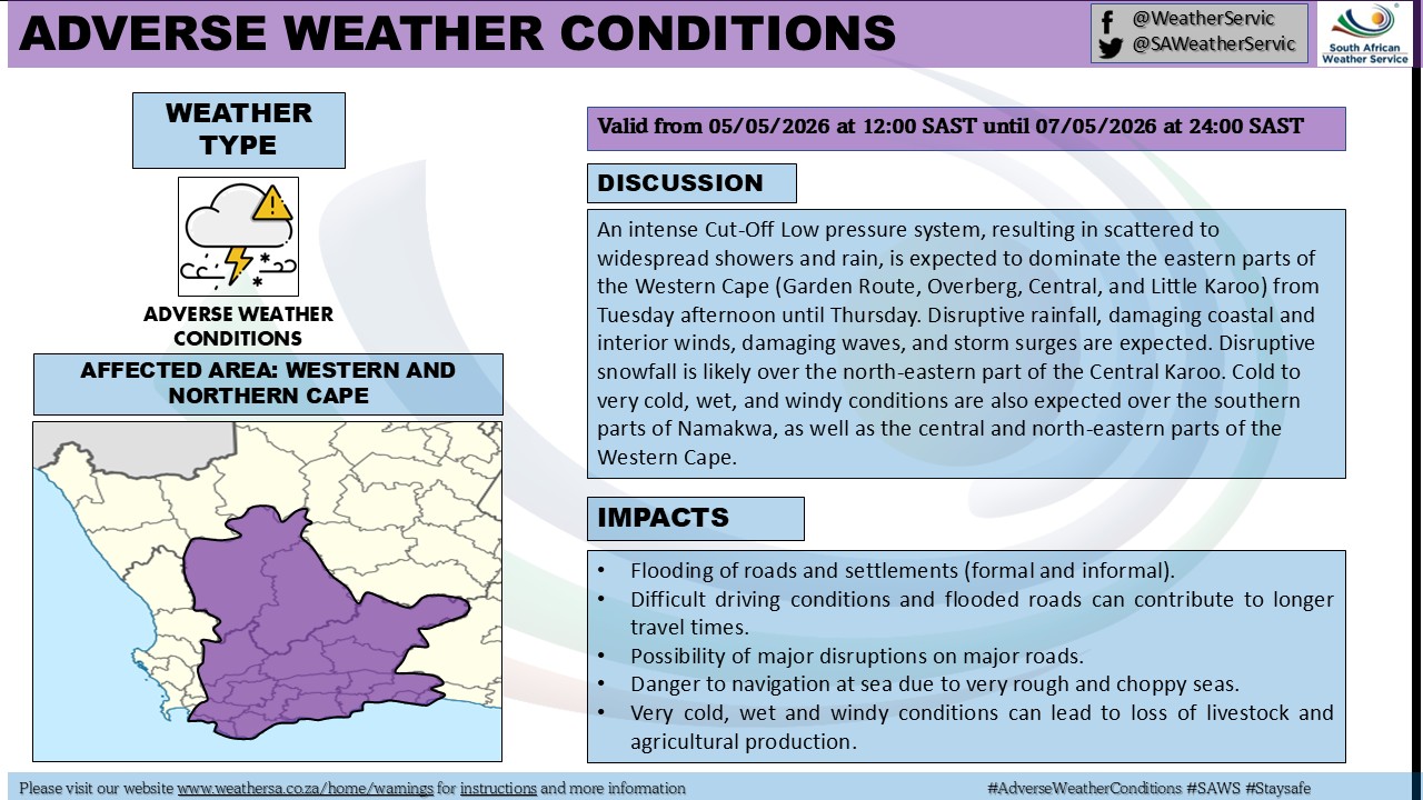
GARDEN ROUTE | KAROO NEWS - An intense cut-off low-pressure system is expected to impact the eastern parts of the Western Cape and the southern regions of Namakwa from Tuesday afternoon through to Thursday, bringing a range of potentially disruptive weather conditions.
According to early warnings from the South African Weather Service, the residents in the affected areas should prepare for periods of disruptive rainfall, which may lead to localised flooding and difficult travelling conditions.
Strong winds are also anticipated over the interior, while coastal regions can expect gale-force winds.
Maritime conditions are likely to deteriorate significantly, with damaging waves and the possibility of a storm surge along the coastline.
The authorities have cautioned that these conditions may pose risks to coastal infrastructure and could impact small harbours and beachfront areas.
In addition, there is a possibility of disruptive snowfall over the northeastern parts of the Central Karoo, which could further affect road networks and accessibility in these regions.
The system is also expected to bring cold to very cold, wet and windy conditions across the southern parts of Namakwa, as well as the central and northeastern areas of the Western Cape.
Residents are advised to remain alert to updates from the local authorities and to take necessary precautions as the weather system develops.
Tuesday 5 May

Wednesday 6 May
‘We bring you the latest Garden Route, Hessequa, Karoo news’