GARDEN ROUTE | KAROO NEWS - Residents across the Garden Route, Karoo and parts of the Western Cape are being urged to remain on high alert as severe weather conditions continue to batter the region today, Thursday 7 May, with more cold fronts expected to arrive early next week.
The South African Weather Service (SAWS) has issued multiple impact-based warnings for disruptive rain, damaging waves and hazardous sea conditions linked to a powerful cold front sweeping across the southern coastline.
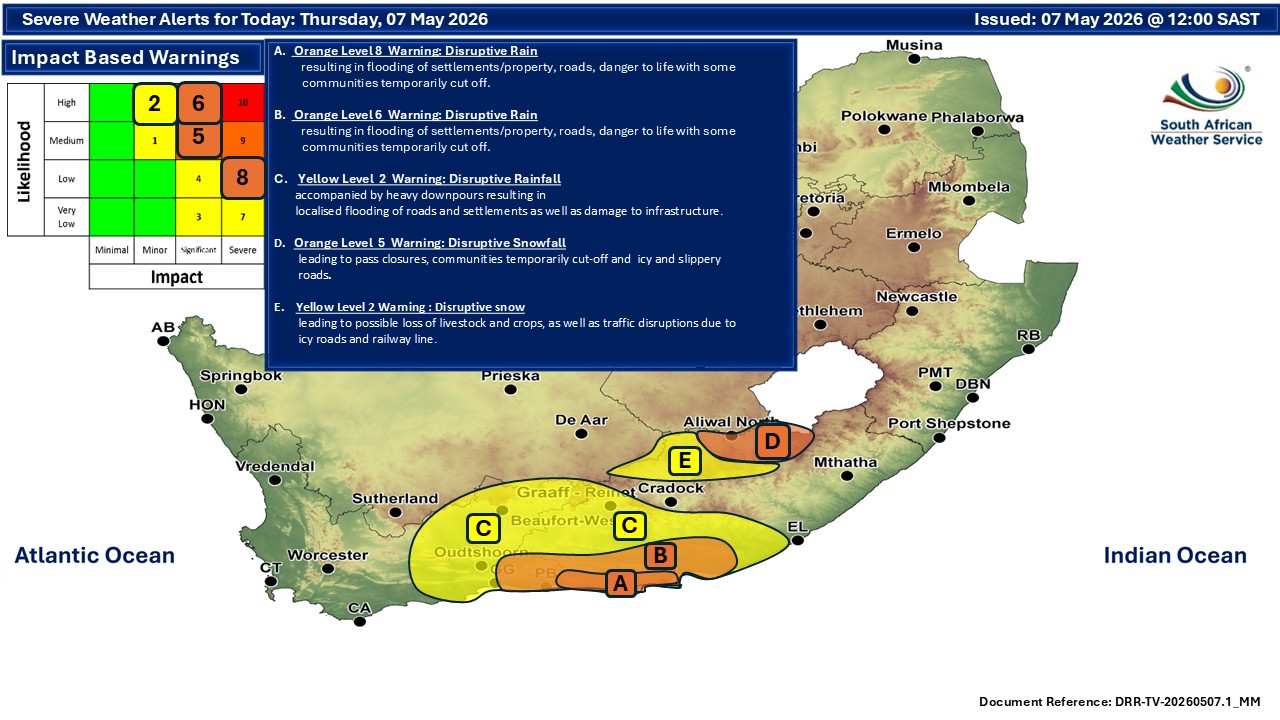
An Orange Level 6 warning for disruptive rain has been issued for the eastern parts of the Garden Route today, where flooding and the displacement of affected communities are expected. Low-lying areas, informal settlements and roads near rivers and drainage systems are particularly vulnerable as heavy downpours continue.
A Yellow Level 2 warning remains in place for the Central Karoo, Oudtshoorn, Kannaland and Hessequa municipalities, where disruptive rainfall could lead to flooding of roads and settlements.
Authorities have cautioned motorists to avoid flooded roads and bridges, while residents living in flood-prone areas are advised to monitor water levels closely and prepare for possible evacuation if conditions deteriorate.
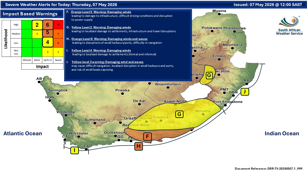
Along the coast, rough seas and large swells are creating dangerous conditions for maritime activities.
An Orange Level 6 warning for damaging waves has been issued between Cape Agulhas and Plettenberg Bay, with waves expected to cause damage to coastal infrastructure and increase the risk of coastal erosion.
A further Yellow Level 4 warning for damaging waves is in effect between Cape Point and Cape Agulhas, where disruptions to small harbours and ports are likely.
The latest weather system forms part of a series of cold fronts affecting the Western Cape this week. According to SAWS, cold to very cold, wet and windy weather conditions are expected across the southern parts of Namakwa, as well as central and north-eastern parts of the province.
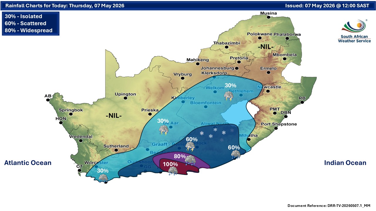
Weather experts say the current system is being driven by a deep Atlantic low-pressure system, feeding moisture-rich air onto the southern Cape coastline.
These winter cold fronts often intensify rapidly when interacting with warmer ocean temperatures along the south coast, resulting in heavy rainfall, gale-force winds and dangerous sea conditions.
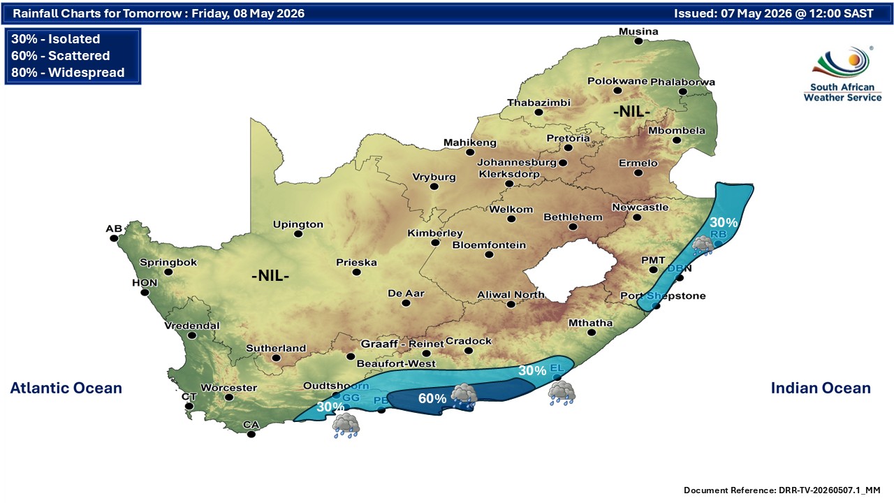
Forecasters have also warned that another cold front is expected to make landfall over the western parts of the Western Cape and south-western Namakwa on Sunday morning, followed by a second system on Monday.
These back-to-back fronts are expected to affect the western and south-western parts of the province, as well as southern and western Namakwa, from Sunday to Tuesday, 10 to 12 May.
Adverse conditions linked to the approaching systems include disruptive rainfall, strong interior winds, gale-force coastal winds and further damaging waves. Cold to very cold, wet and windy weather is also expected to persist across large parts of the province.
Emergency services are urging residents to secure loose outdoor items, avoid unnecessary travel during severe weather and stay updated through official SAWS forecasts and municipal emergency channels.
No fire danger warnings have been issued at this stage.
‘We bring you the latest Garden Route, Hessequa, Karoo news’