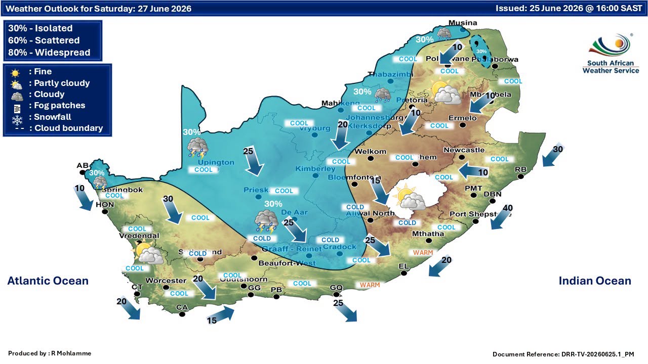
GARDEN ROUTE | KAROO NEWS - The Garden Route and surrounding regions can expect generally mild winter conditions on Saturday, 27 June, with partly cloudy skies forecast across most areas and little chance of rainfall.
In the Karoo, Beaufort West and Prince Albert are expected to reach highs of 22°C and 23°C respectively, with temperatures dipping to around 11°C and 12°C overnight. Both areas are likely to experience partly cloudy conditions throughout the day, accompanied by north-westerly winds of around 28km/h.
Further south, Ladismith and Oudtshoorn are forecast to see warmer daytime temperatures of 24°C, with partly cloudy skies expected. Winds are likely to remain moderate, blowing from the north-west at around 19km/h.
Along the coast, cooler conditions are expected. Hermanus and Cape Agulhas are set for daytime highs of 19°C, with early morning fog likely before skies gradually clear to partly cloudy conditions later in the day.
Stronger winds of up to 28km/h are expected around Hermanus, while Cape Agulhas could see westerly winds of around 19km/h.
Swellendam and Riversdale are both forecast to reach 22°C, with a mix of partly cloudy and cloudy conditions expected before skies improve later in the day.
Meanwhile, Garden Route towns are expected to enjoy relatively pleasant conditions. George should see a high of 21°C and a low of 13°C under partly cloudy skies, while Knysna is expected to reach 22°C after a cloudy start, with conditions becoming partly cloudy as the day progresses.
Rainfall is not expected across any of the listed areas, with precipitation chances remaining at 0%.
Cape Town and Cape Winelands face potential weather disruptions
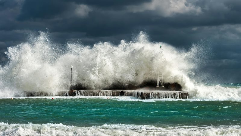
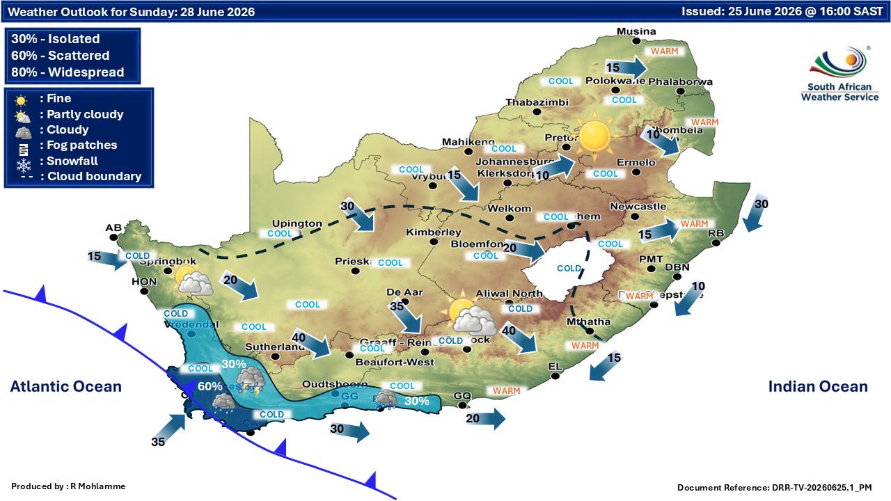
Residents across parts of the Western and Northern Cape are being urged to prepare for a spell of severe winter weather, with forecasters warning of disruptive rainfall, strong winds and cold conditions expected to affect several regions from Sunday into Monday.
Heavy rainfall is expected to impact the City of Cape Town and the Cape Winelands from Sunday afternoon, prompting a Yellow Level 4 warning.
The rainfall could lead to localised flooding in vulnerable formal and informal settlements, low-lying areas, roads and bridges, potentially causing disruptions to traffic and daily activities.
Authorities are also warning of hazardous conditions at sea. A Yellow Level 2 warning for damaging winds and rough seas has been issued for coastal areas between Cape Columbine and Cape Agulhas from Sunday through to Monday morning.
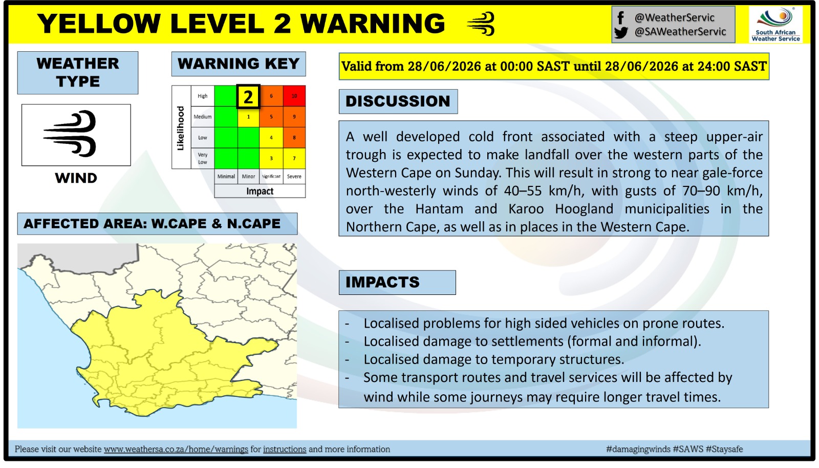
Strong interior winds could create challenges for high-sided vehicles
The combination of strong winds and large waves could make navigation difficult for smaller vessels and marine operators.Further inland, strong winds are expected to affect parts of the southern Namakwa District in the Northern Cape, as well as sections of the Western Cape.
A Yellow Level 2 warning has been issued, with motorists advised to exercise caution on exposed routes where crosswinds may become problematic, particularly drivers of high-sided vehicles such as trucks, buses and vehicles towing trailers.
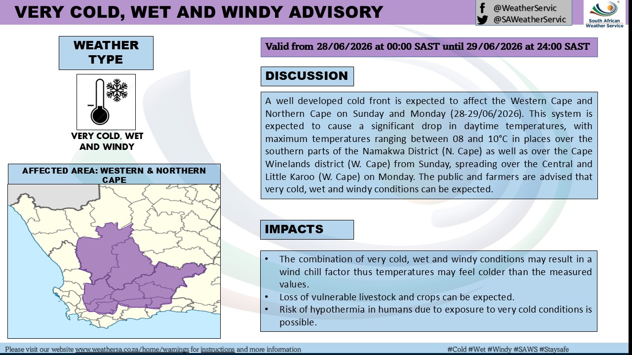
Bitterly cold conditions set to spread across parts of the Western Cape
In addition to the warnings, forecasters have issued an advisory for very cold, wet and windy conditions across the southern parts of Namakwa and the Cape Winelands on Sunday.These conditions are expected to spread into the Central Karoo and Little Karoo by Monday.
No fire danger warnings have been issued at this stage, with wet weather conditions expected to reduce the risk of veld fires in affected areas.
‘We bring you the latest Garden Route, Hessequa, Karoo news’